Tortolita Mountain Park: A High and Hidden Mountain Bike Marvel
From the valley floor the Tortolitas don't look like much. A low, unassuming range on the northwest horizon — smaller than the Catalinas, quieter than the Tucson Mountains, easy to overlook from the freeway. Most riders pass them on the way to somewhere else.
That's a mistake.
Tortolita Mountain Park Defined
Tortolita Mountain Park contains a 29-mile mountain bike network in chunky terrain northwest of Tucson — rocky, rugged, surprisingly deep, and home to one of the best trails in the greater Tucson area. The trails climb from the alluvial basin into exposed mountain terrain that feels genuinely remote despite being thirty minutes from downtown.
This is a network that rewards riders who show up prepared and surprises everyone who underestimates it.
Should You Ride Tortolita Mountain Park?
Ride it if:
- You're a strong intermediate or expert looking for a technical desert mountain experience beyond the valley networks
- You want genuine backcountry feel without driving to Mt. Lemmon
- You're a Honeybee regular who's ready for the mountain above it
- You want big views over the Tucson basin from a surprisingly good vantange point
- You appreciate trail systems with real history underneath them
Skip it if:
- You're a beginner or early intermediate — the terrain demands real bike handling and fitness
- You want a quick lap with easy options in and out
- You're expecting Honeybee with more elevation — this is a fundamentally different riding experience
New to Tucson? Kick Things Off with Tucson Mountain Biking: Start Here →
Quick Stats
- Trail Miles: ~29 miles (Tortolita Mountain Park) + 9 miles (Tortolita Preserve — separate, see note below)
- Elevation Gain: Significant — this is mountain terrain
- Difficulty: Intermediate to Black
- Surface: Exposed rock, rocky singletrack, some hardpack, old jeep road
- Best Season: October–April
- eMTB: Limited, Marana and State Trust-managed land (yes), Pima County-monaged land (no)
- Access: West from Dove Mountain/Marana; east from Honeybee Canyon area
- Managed by: Pima County and Town of Marana jointly
- Permits: Required for parking on Arizona State Trust Land (east entrance, off Edwin Road)
- Destination: Tucson
What to Expect
Honeybee/Rail X and Tortolita Mountain Park bleed into one another on the map — both sit in the northwest corner of the Tucson riding area — but they are fundamentally different experiences.
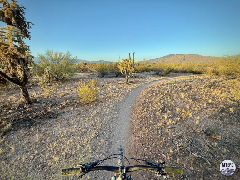
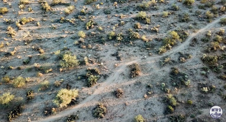
Honeybee/Rail X is all about shredding the basin. The trails ride on hardpack alluvial sediment, the terrain undulates gradually, the character is fast and open. It's the valley floor doing its best desert singletrack and doing it well.
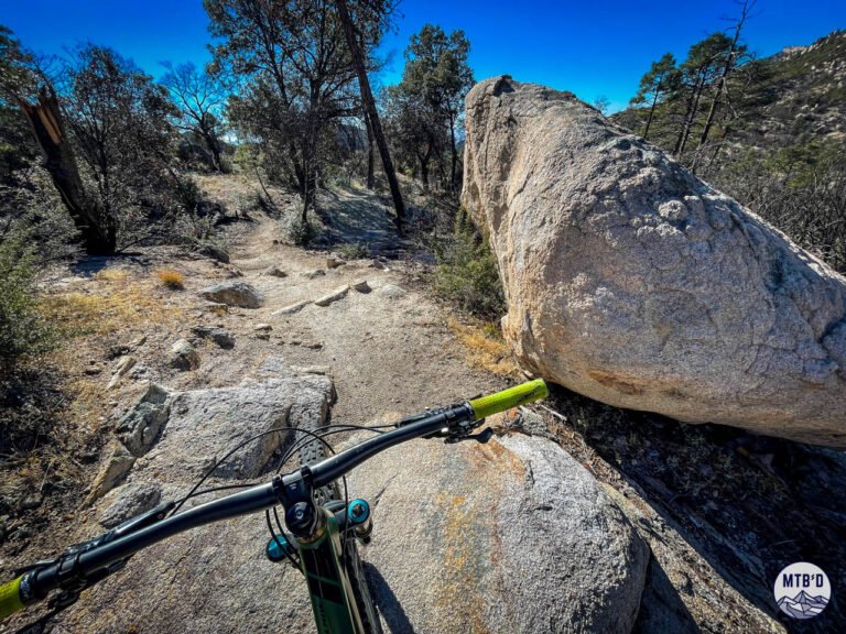
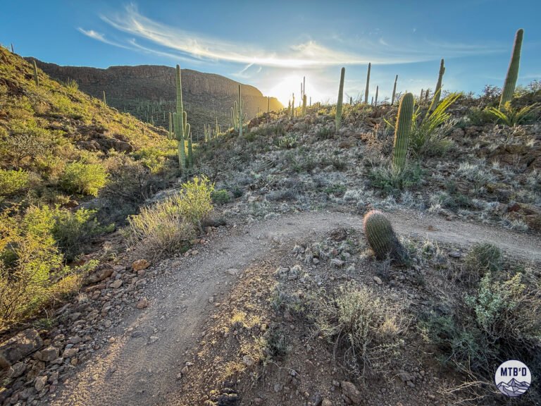
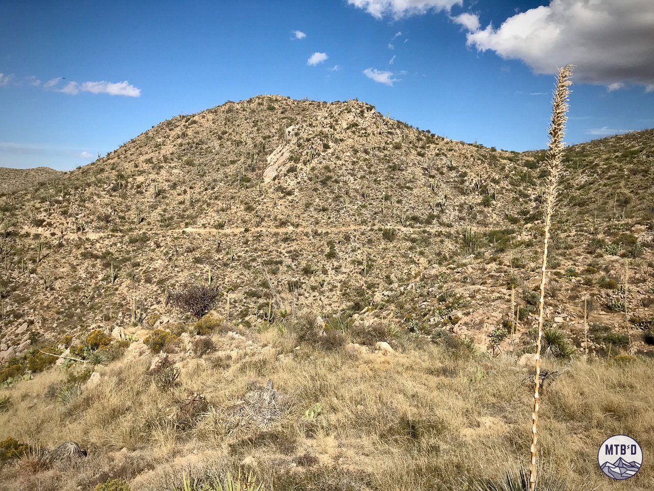
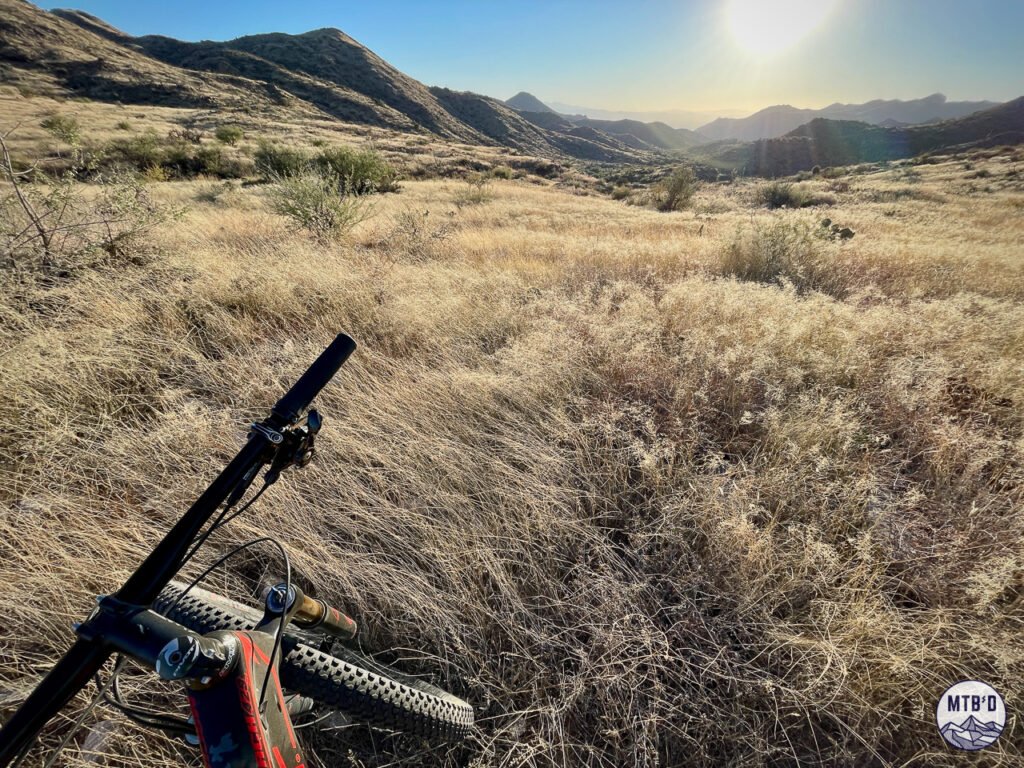
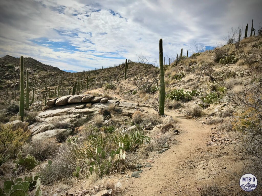
Tortolita Mountain Park is what happens when you climb out of that basin into the ranges above it. The geology shifts from sediment to exposed rock. The terrain steepens. The trails get technical. The views open up. Suburbia retreats.
See What's Coming. Ride the Good Stuff.
Get on-the-ground updates as trails transform and conditions change.
Don't fly blind in Tucson.
A single steep connector trail — an old jeep road — links the two systems, climbing hard from the flats into the mountains. It's not a casual transition. The elevation change is honest and the terrain announces immediately that you've left Honeybee's character behind.
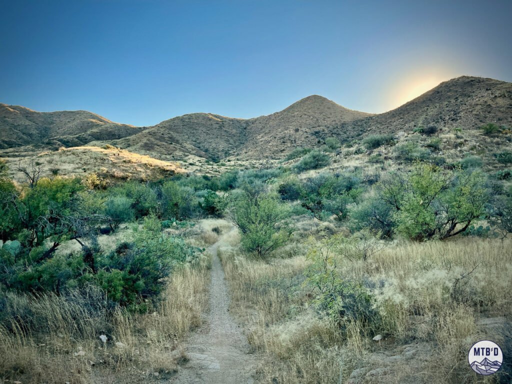
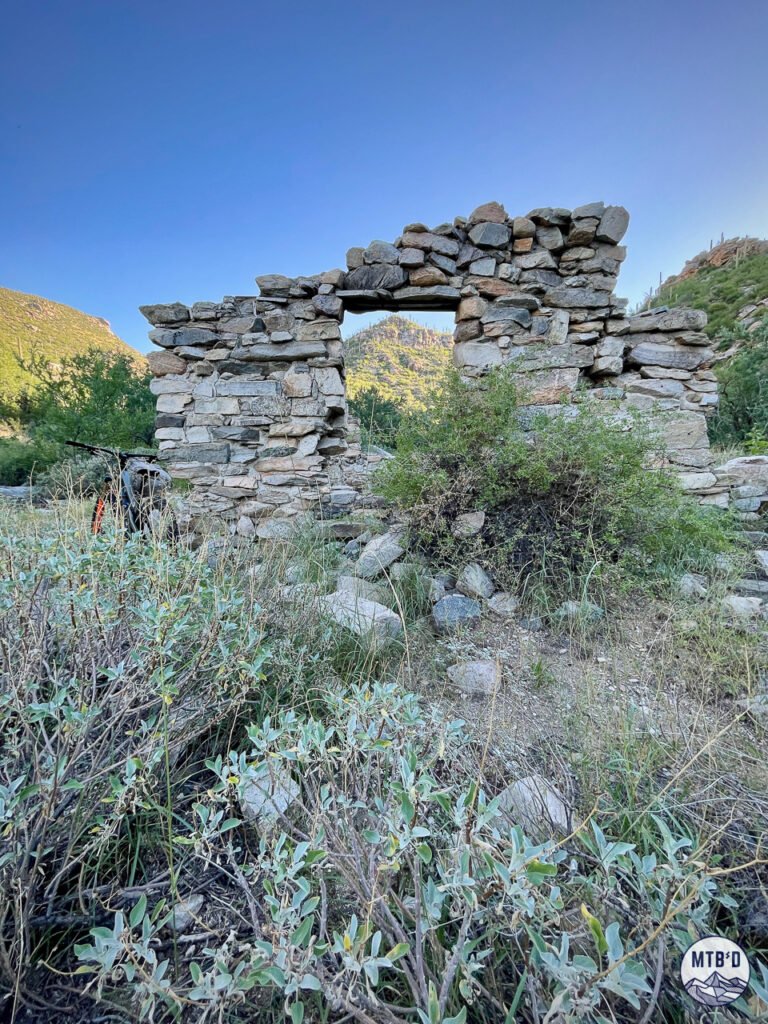
What you find at the top is a perched valley in the heart of the Tortolitas — a landscape that feels genuinely remote despite the sprawling development visible from the ridgelines above. Cattle tanks, windmills, an old stone corral, remnants of water capture systems built by ranchers who worked this terrain long before mountain bikers arrived. Other materials hint at even older occupation — the Hohokam farmed and settled these mountains for over a thousand years.
The Tortolitas don't look deep from the valley floor. They are deeper than anyone expects.
How the Network Works
Tortolita Mountain Park divides naturally by access point and character.
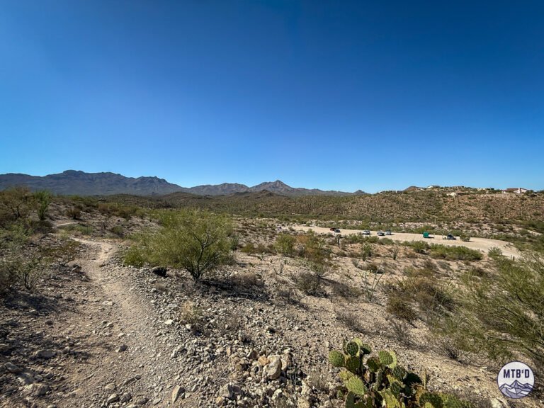
East Access — Honeybee Canyon area Perhaps the more approachable entry point, but longer. Trails on the eastern side have flow but the connector climb from the basin is real — steep and honest — big terrain change.
West Access — Dove Mountain Up a wash and straight to a hike-a-bike. The Alamo Springs approach from this side includes a hike-a-bike — not optional, just part of the deal. Stone structures near the trailhead hint at the ranching and pre-contact history of the area.
The Perched Valley The heart of the network sits in a natural valley between the ridgelines — sheltered, surprisingly alive in good years, with the cattle tank and windmill that mark the old ranching infrastructure still standing. This is where the two access points converge and where the best riding dwells.
The navigation reality: Tortolita is pretty simple, but it's commiting. Have a route in mind, know your access and egress points, and understand that connecting between any of them invites an adventure.
Trails Worth Knowing
Ridgeline Trail — The standout. Ridden east to west it's one of the best trails in greater Tucson — big views, genuine elevation, rocky technical character that rewards commitment without demanding expert skills. Built with grade in mind despite the demanding terrain it crosses. Don't miss it.
Wild Burro — The main ecorridor. Meanders through the canyon terrain with a mix of smooth and rocky sections. Well-signed, manageable, the natural spine of the eastern network.
Wild Mustang — More demanding than Wild Burro, the spine of the upper network. Builds on Wild Burro's character with more elevation and technical terrain.
Upper Javelina — An awesome descent, east to west. But unless you do an out and back, this one is well-earned.
Alamo Springs — Access from Dove Mountain. Includes the hike-a-bike section (going up or down). Not glamorous, but often essential.
Full vetted routes with GPX files in the Tucson MTB Ride Guide.
Navigation Reality Check
Tortolita is manageable but requires more preparation than most Tucson networks. The two access points — east and west — don't connect casually. Riders who show up without a plan and start exploring can find themselves committing to terrain and distance they didn't anticipate.
Download Trailforks before you go. Know which access point you're using. Understand that the hike-a-bike on Alamo Springs is part of the western approach — not a surprise, just a reality.
Who It's For / Skip It
Ride Tortolita if: You're a strong intermediate or expert who has exhausted Honeybee's flat character and wants the mountain above it. You want genuine backcountry feel within thirty minutes of Tucson. You want the best views in the northwest Tucson trail system. You want Ridgeline.
Skip Tortolita if: You're a beginner or early intermediate. You want a quick, low-commitment lap. You're not prepared for real elevation change and rocky technical terrain.
The Good
The terrain depth is the main event. Tortolita delivers a genuine mountain experience that the basin networks — Honeybee, Sweetwater, Fantasy Island — can't approach. Rocky, rugged, elevated, and surprisingly remote for a trail system thirty minutes from downtown Tucson.
Ridgeline alone justifies the drive. It's one of the best trails in the Tucson system and one of the least known outside the local riding community. The views back over the basin from the ridgeline are the best available from any trail in northwest Tucson.
The connection to Honeybee creates a genuinely interesting combined ride — basin to mountain in one session, two completely different characters linked by one steep connector. That's a unique option in the Tucson trail system.
The history. Ranching infrastructure still standing in a perched mountain valley, Hohokam presence stretching back over a thousand years, stone structures that predate the trail system by centuries. Tortolita has history and the terrain carries it quietly.
The Bad
The distance from town is real. Thirty minutes northwest, plus getting into the network puts Tortolita out there. Worth it — but it requires more planning and commitment than a quick lap at Sweetwater or Fantasy Island.
The western approach is not make-believe hike-a-bike. Riders who enter from Dove Mountain without knowing what they're getting into may become disappointed. The hike-a-bike on Alamo Springs requires carrying the steed up a legit strech of rocky terrain.
The network get stinking hot in the summer. A "high" network, but only relatively speaking. Timing is key.
The Dirty
The Tortolitas are the most underrated range on the Tucson horizon. From the valley floor they look like a footnote — a low, unremarkable ridge that doesn't compete visually with the Catalinas or even the Tucson Mountains. Most riders dismiss them without a second look.
Get up into the perched valley and the perspective shifts completely. The range is bigger and deeper than it appears. The terrain is more serious. The remoteness is loveable.
A Note on Tortolita Preserve
The Tortolita Preserve — accessed from Dove Mountain to the south — is a separate system from Tortolita Mountain Park despite the shared name and geographic proximity. The Preserve sits in the alluvial basin like Honeybee rather than up in the mountains.
Nine miles of beginner to intermediate singletrack through ironwood forest and Sonoran Desert — smoother, flatter, and more approachable than the mountain park above it.
Worth knowing for beginners or for a recovery day when the mountain terrain isn't the call. It's a different experience and deserves its own attention.
The Verdict
Tortolita Mountain Park is Tucson's best-kept secret in plain sight. The range sits on the northwest horizon and most riders never look twice at it. The ones who do find a network that delivers genuine mountain terrain, real backcountry character, and one of the best trails in the Tucson system — all within thirty minutes of downtown.
Don't underestimate the Tortolitas.
See What's Coming. Ride the Good Stuff.
Get on-the-ground updates as trails transform and conditions change.
Don't fly blind in Tucson.